


Jack Zhu
Member
-
Joined
-
Last visited
-
Thank you :) , and I also previously created a topic related to RNP AR approaches, could you please handle it? Thanks again!😄
-
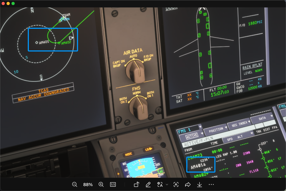
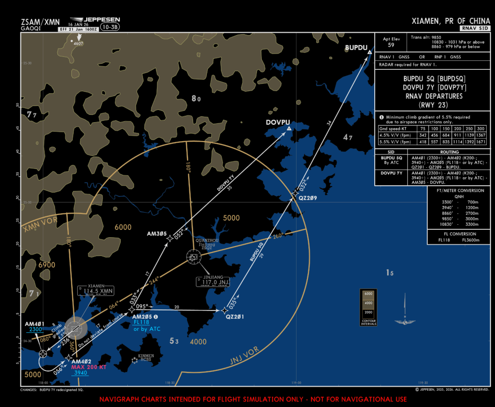
Using ZSAM DOVP7Y departure, the AM401 should be flyover point as displayed on MCDU, but the path on ND passes abeam of this point rather than overflying it.
-
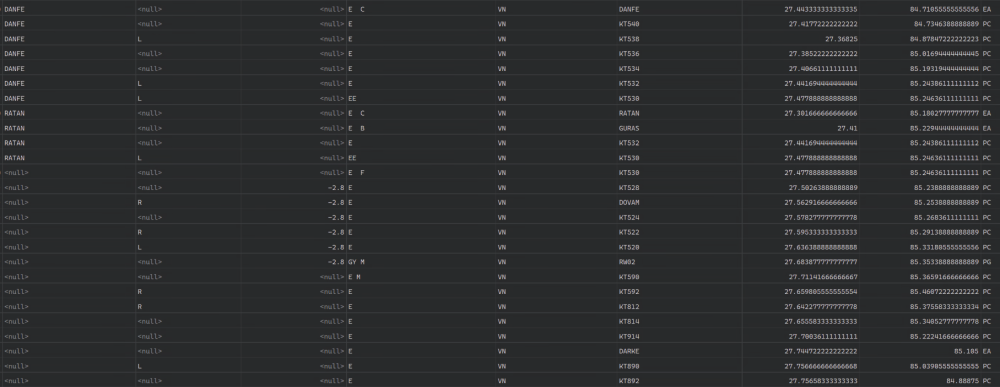
I have flown the approach, the plane just fly follow the path on ND. I calculated the deviation compare to the RF leg, it's about 1.6nm, that's far from 0.3nm. Anyway, just making a RF leg into a direct leg is not acceptable for any RNP (AR) approach The database is from navigraph. That's just a part of the database, I think the problem comes to the waypoint_description_code, when the second line of KT530 is "E I", the path is a RF leg, when not, is a direct leg. But navigraph's database is right, Accroding to the ARINC 424, the second line of KT530 can't be "E I", should be 'E F'. So I think there is something wrong when the aircraft processing the path. Thank you for your patience.

-
RNP AR procedure always require at least RNP 0.3nm, so I think replace the RF leg with a direct leg is not acceptable🤔. Also, there is terrain ahead🙃
-
Also with RNP AR Z I think this issue also happens on A340

-
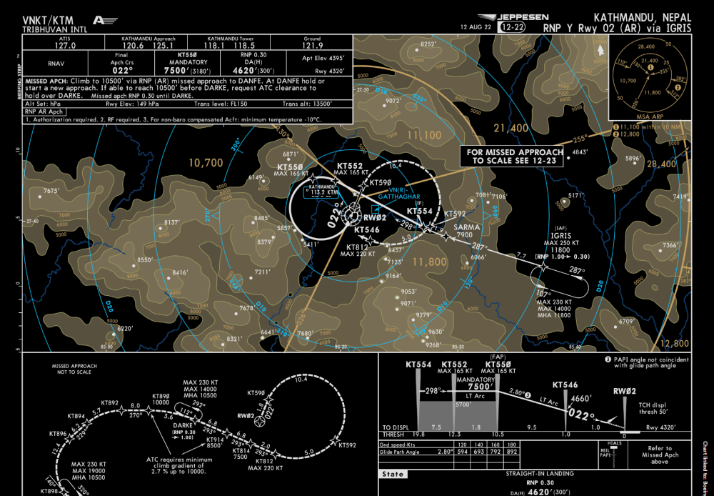
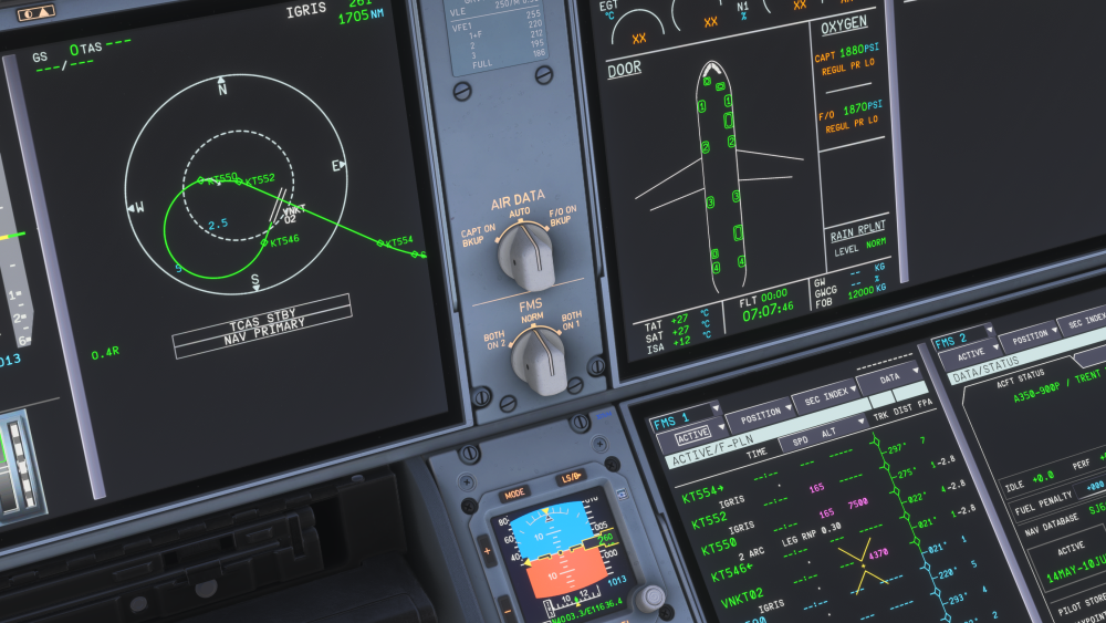
In VNKT RNP Y Rwy 02 (AR) Approach via IGRIS, the leg between KT552 and KT550 should be a RF leg, but in ND and MCDU, it's just a straight line KT550 is the last point in approach transition and the first point in final approach. There are two lines in database, the first line is approach transition with path_termination 'RF' and waypoint_description_code 'EE ', while the second line is final approach with path_termination 'IF' and waypoint_description_code 'E F'. So I think there is something missed when the aircraft processing the path.